
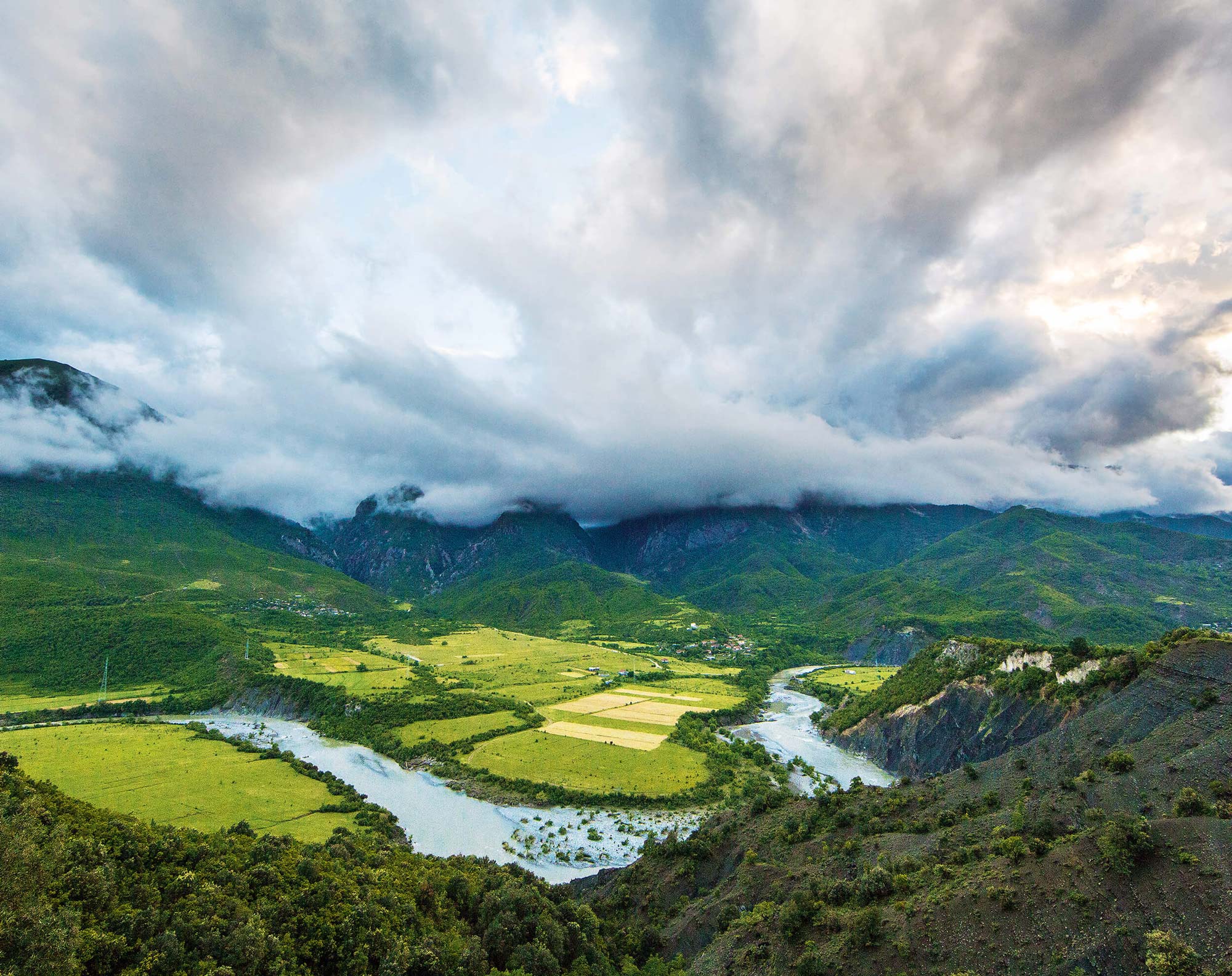
From the last wild river in Europe to a spring so clear it defies explanation — and finally to a coastline the world is only beginning to discover.
VJOSA · BLUE EYE · KSAMIL – SOUTHERN ALBANIA
Introduction
There is a corner of Europe where the rivers still move exactly as they please. Where mountains drop their meltwater into gorges no dam has ever interrupted, where gravel banks shift with the seasons and sandbars rise and vanish like thoughts. This is southern Albania — one of the continent’s last truly unhurried places, and the setting for one of its most extraordinary journeys.
The route begins on the banks of the Vjosa, the final great wild river on the European mainland. It passes through the shade of ancient plane trees to the Blue Eye — a karst spring of almost supernatural colour — before descending to Ksamil, a small town of white beaches and turquoise water on the edge of the Ionian Sea. Three stops. Three entirely different encounters with nature. One unforgettable road.
The Vjosa — Europe’s Last Wild River
A river that has refused, against enormous pressure, to be tamed.
The Vjosa (also spelled Vjosha, or Aoos in Greek) is not merely a river. It is a statement. Rising in the Pindus Mountains of northern Greece, it crosses into Albania near Çarshovë and flows north-westward for 272 kilometres in total — 192 of them through Albanian territory — before emptying into the Adriatic north of Vlorë. Its water quality is the best in the country, suitable for all uses, and its crystal clarity is visible from a great distance: the river meanders through pale sand and gravel banks in broad, braided channels, forming small islands, splitting into arms, and rejoining with an unhurried confidence.
What makes the Vjosa extraordinary in a European context is precisely what it lacks: interruption. Across the continent, almost every river of this size has been fragmented by dams, straightened for navigation, or drained for agriculture. The Vjosa and its tributaries flow freely along the entire stretch from source to sea — a 400-kilometre network of wild waterways that supports over 1,000 species and at least eight habitat types classified as the highest conservation priority in the European Union.
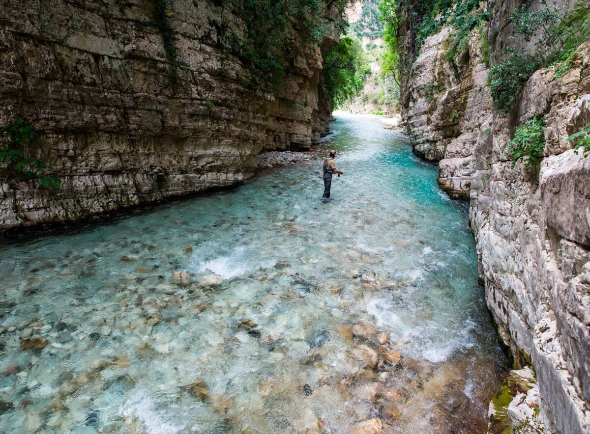
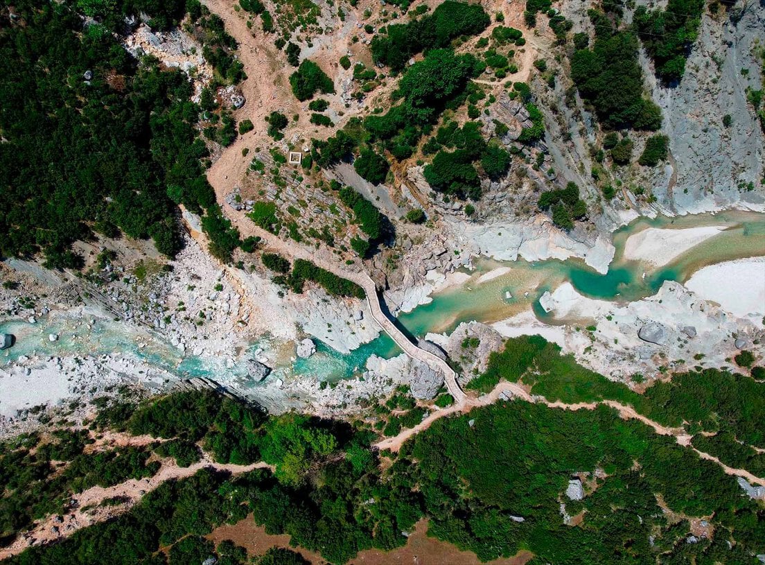
In its middle course alone, the riverbed stretches wider than ten football pitches in places. Narrow gorges in the upper section give way to wide gravel plains and sandbanks, then a naturally functioning delta on the Adriatic coast. The Këlcyra Gorge, where the river cuts through limestone cliffs east of Tepelena, is perhaps the most dramatic passage: a medieval castle once controlled this chokepoint, and the Romans before that built their settlements along the same route.
The town of Përmet is the Vjosa’s cultural heart. Known as the greenest and cleanest city in Albania — and affectionately called the “City of Roses” — it sits nestled in the valley with a population of just over 10,000. It is famous for its folk music, its preserved desserts called gliko, its local wine and raki, and the remarkable Ottoman-era Katiu Bridge that spans the nearby Lengarica River.
“The Vjosa’s rich environment is home to playful otters, threatened Egyptian vultures, and microscopic organisms — 13 animal species and two plant species assessed as globally threatened by the IUCN.”
Just south of Përmet, at the foot of the Katiu Bridge, lie the Benja Thermal Baths — three natural pools fed by the Lengarica River and said to have therapeutic properties. Locals have bathed here for generations, and the setting, in the shade of the gorge with the Ottoman arch overhead, is unlike anything you are likely to find elsewhere in Europe.
For the more adventurous, the Vjosa is the finest rafting and kayaking river in the Balkans. Multi-day kayak expeditions travel the full Albanian length of the river from the Greek border to the Adriatic, camping on gravel banks and swimming in pools of startling clarity. Even a three-hour whitewater rafting tour from Përmet provides a memory that will not fade quickly.
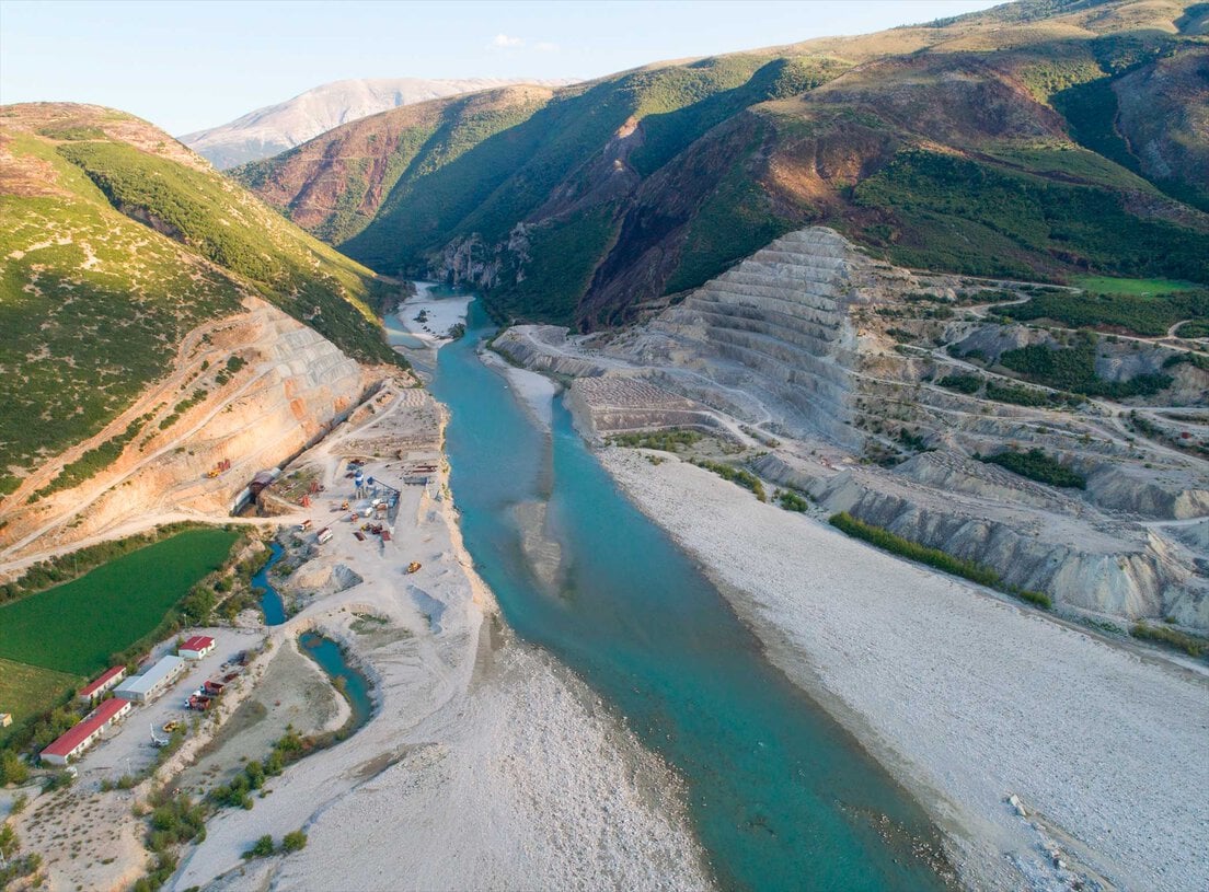
The Vjosa’s survival has not been accidental. For decades, there were plans for 40 hydropower plants within the catchment area — nine on the Vjosa itself, and 31 on its tributaries. Three tributaries have already been lost to dams. The river’s protection became an international cause, backed by conservation organisations, scientists, and eventually the outdoor brand Patagonia, which co-signed a declaration of intent with the Albanian government in June 2022. In March 2023, Albania formally established Europe’s first Wild River National Park on the Vjosa — a decision hailed by National Geographic, the Guardian, and Lonely Planet alike as a historic moment for river conservation.
The Vjosa Valley is also an archaeological landscape. The ancient Illyrian hill town of Byllis sits high above the river in Mallakastra, one of the most beautiful historical sites in Albania. The Leusa Church of St Mary, two kilometres from Përmet, is a late 18th-century monastery surrounded by dense forest, its interior covered in Orthodox icons and frescoes — a cultural treasure accessible only on foot or by off-road vehicle.
Syri i Kaltër — The Blue Eye
A spring so deep, so cold, and so perfectly blue that legend has always found it before science did.
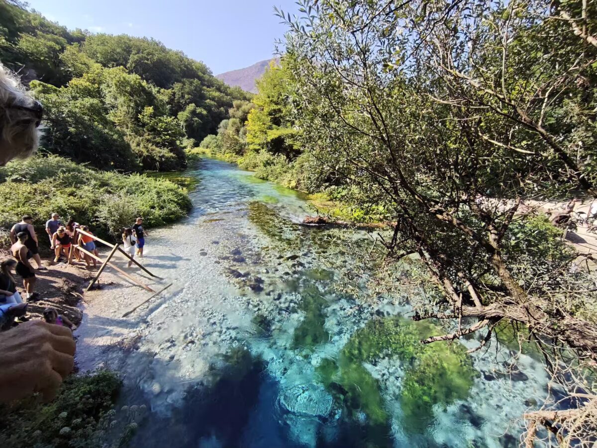
From Përmet, the road south follows the Drino valley toward Gjirokaster, then sweeps toward Sarandë. But between those two cities, near the village of Muzinë at the western foot of Mali i Gjerë, the mountain keeps a secret. The Blue Eye — Syri i Kaltër in Albanian — is a karst spring of a kind that has no real parallel in Europe. Cold, crystal-clear water rises from a vertical shaft of unknown depth, surging upward with such force that it creates the impression of a cauldron boiling in slow motion, though the water is ice-cold.
The spring emerges at the point where the karst limestone of Mali i Gjerë meets an impermeable rock formation below. Because the underground karst system is far larger than the visible topographic basin above it, more water flows from the spring than falls as rainfall in the immediate area — the coefficient of flow reaches 1.21, meaning the Blue Eye draws on precipitation from the entire eastern slope of the mountain, which percolates through an enormous network of underground caverns before erupting upward in this single, spectacular source. This is where the Bistrica River is born.
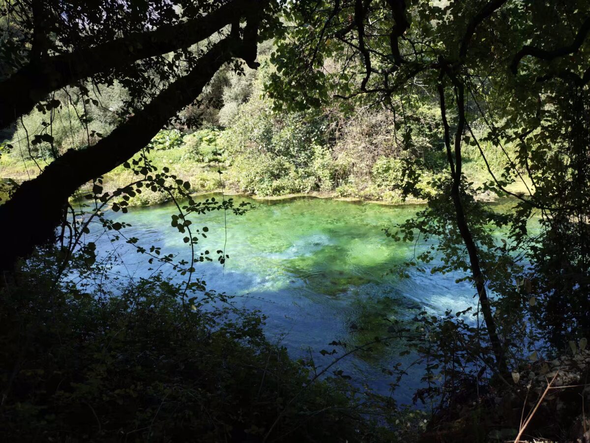
The spring’s average annual discharge is 6 cubic metres per second. At its centre — the bebja, or pupil — the water appears almost black-blue, a colour produced by the depth and the angle of light descending into the shaft. Moving outward from the centre, the water brightens through cobalt and turquoise before settling into a pool ringed by ancient Oriental plane trees (Platanus orientalis), oaks, and a dense, almost jungle-like undergrowth of Mediterranean vegetation. The effect is such that the boundary between water and forest is genuinely difficult to determine.
There are eighteen karst springs in the immediate area, but the Blue Eye is the largest and most dramatic by a considerable margin. In 2022, the Albanian government upgraded its protected status from a natural monument to a full natural park, expanding the protected area from 180 to 293 hectares. Within this ecosystem, researchers have recently identified species new to Albania, including a rare bat species, alongside at least seven natural habitat types and several endemic plant species.
“From antiquity to today, people have seen this spring as a beginning of life. Near the ancient cities of Finiq and Butrint, it may well have served as a ritual centre — a place where offerings were made to the gods of water.”
The human relationship with the Blue Eye runs back to antiquity. The spring’s proximity to the ancient cities of Finiq and Butrint suggests it may have functioned as a site of religious ritual — a place where offerings of wine, tools, and animals were made to the water gods. Today, people still throw coins into the pool for good luck, a gesture that connects the modern visitor to a thread of reverence stretching back thousands of years. Even for those who arrive without any knowledge of this history, the spring produces an instinctive hush: something about the depth and colour of the water demands a moment of quiet.
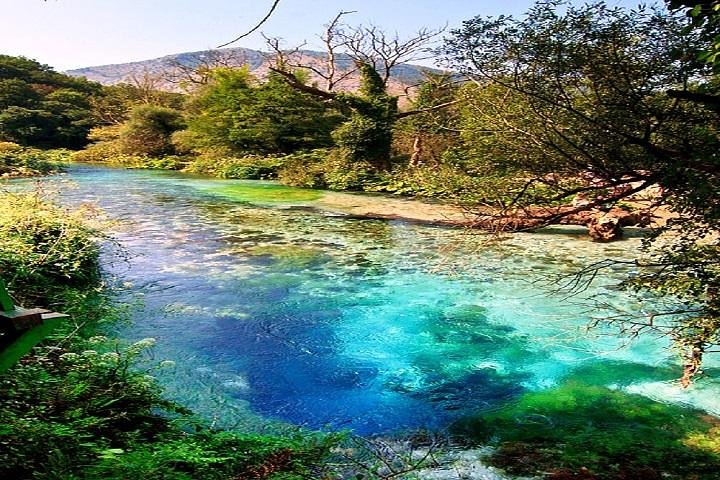
The walk through the park to reach the spring follows a shaded forest path along the Bistrica stream. It takes only a few minutes from the car park, but the transition — from the sunny Albanian road into cool, green shade — is immediate and total. On hot summer days, the temperature at the spring is noticeably lower than anywhere nearby. The water itself maintains a constant temperature throughout the year.
Ksamil — The Pearl of the Albanian Riviera
Where the Ionian Sea turns a colour that seems impossible until you are standing in it.
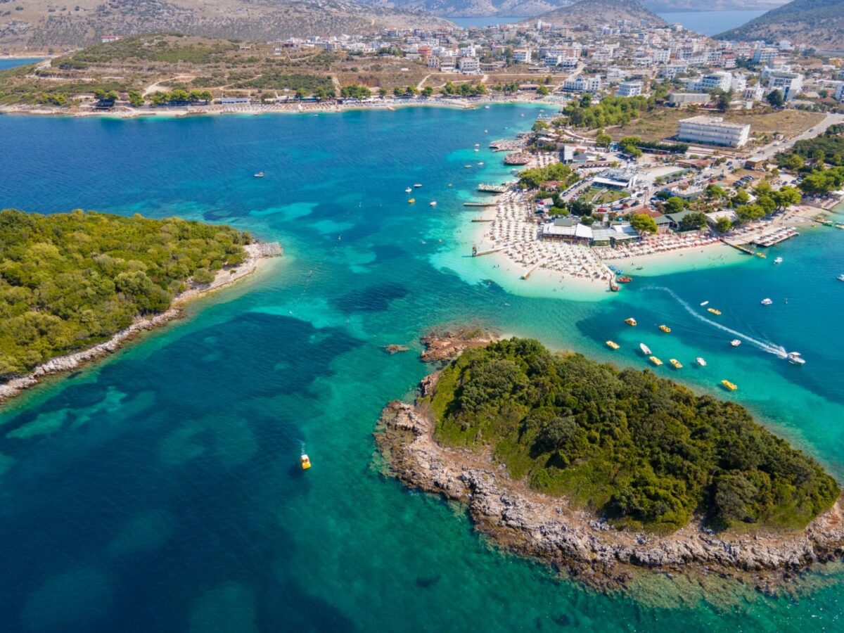
The final descent to Ksamil is one of the most anticipated moments on the Albanian Riviera — and it delivers. The town sits south of Sarandë, at the end of the road that leads toward the Butrint archaeological park, perched between the Ionian Sea to the west and the freshwater lagoon of Butrint to the east. The result is a landscape that is, quite literally, surrounded by water: the Ionian channel separating Albania from Corfu to the west, and the calm, reed-fringed lagoon to the east. From an aerial perspective, Ksamil appears almost as an island.
The beaches — long, white-sand stretches separated by small rocky headlands — face directly across the narrow channel toward Corfu. The water here is shallow and extraordinarily clear, warming quickly in summer and maintaining the vivid turquoise that has earned Ksamil comparisons with the Maldives in Albanian travel writing — hyperbolic, perhaps, but not entirely without basis when the light is right and the sea is calm. Elevations range from 7.5 to 15 metres above sea level on the small offshore islands, which are covered in dense Mediterranean scrub.
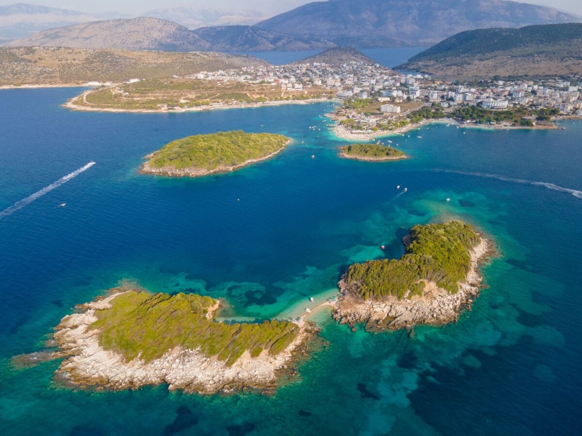
Those islands — three small rocky outcroppings known simply as the Three Islands — are the iconic image of Ksamil and easily accessible by a short swim or a boat taxi from the beach. Their vegetation is characteristically Mediterranean: low, wind-sculpted shrubs, wild herbs, and in spring, flowers that attract insects from the mainland. Between the islands and the shore, the sea floor is clear enough to read the texture of the sand below. Snorkelling here reveals a world of colourful coral formations, diverse fish, and, in some areas, submerged historical relics — a reminder that the Ionian has been a thoroughfare of civilisations for millennia.
Ksamil was, until relatively recently, a small fishing village best known as the access point for the Butrint archaeological park. Butrint, a UNESCO World Heritage Site, is one of the most remarkable archaeological sites in the Mediterranean — a walled city that was inhabited continuously from the Bronze Age through the Ottoman period, its ruins now managed within a national park of extraordinary natural beauty. The two sites together — Butrint and Ksamil — form a combination that is difficult to match anywhere on the European coast.
“Ksamil is surrounded by water — the Ionian Sea to the west, the magnificent lagoon of Butrint to the east. Its crystalline waters, the famous Three Islands, and the channel toward Corfu make this one of the Riviera’s most complete destinations.”
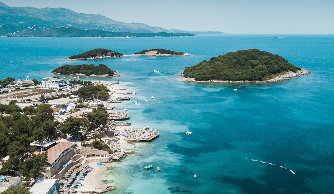
For hikers, the slopes above Ksamil and the tracks along the Albanian Riviera offer a different kind of engagement with the landscape: following the curves of the coastline on foot, with views down to coves that can only be reached by swimming or climbing. The area rewards those who move slowly, who are willing to leave the main beach for the half-hidden bays in either direction along the shoreline.
The town’s culinary character is built around the sea. Fish restaurants line the waterfront — sea bream, sea bass, octopus, and locally caught shellfish — most of them with terraces that look directly out over the channel toward the Greek island. The Albanian coast produces a distinctive style of seafood dining: generous, unhurried, and priced at a fraction of comparable restaurants across the Adriatic in Italy or Greece.
Ksamil is family-friendly in the truest sense — the shallow, sheltered waters near the beach are gentle enough for children, the distances between restaurants and accommodation are short, and the pace of life during the summer months is relaxed without being dull. The town has grown rapidly in recent years, its reputation spreading across Europe by word of mouth, and in summer the streets and beaches fill with visitors from across the continent. Yet even at its most crowded, the quality of the water and the presence of the Three Islands keeps Ksamil feeling like somewhere that genuinely earns its visitors’ admiration.
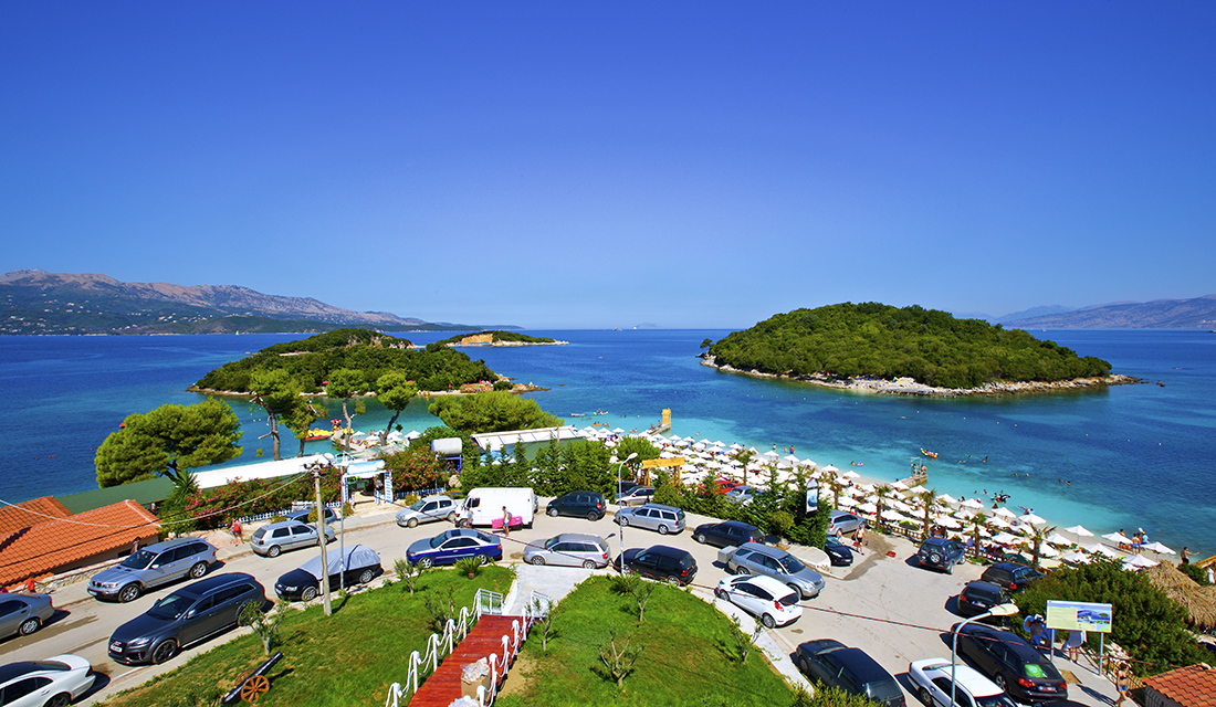
At the end of an afternoon on the beach, as the light flattens and turns gold over Corfu and the Ionian ripples purple in the early evening, it becomes clear why this corner of Albania — wild river, blue spring, turquoise sea — is quietly becoming one of the continent’s most treasured journeys.
How to Connect the Three
The natural route from Tirana runs south on the national highway through Fier and Vlorë, then into the Vjosa Valley via Tepelenë. Allow at least a full day in and around Përmet — the Benja Thermal Baths and Katiu Bridge alone merit a morning. Continue south through Gjirokastër (a UNESCO World Heritage city in its own right, worth an overnight stop) and join the road toward Sarandë. The Blue Eye is signposted off the Gjirokastër–Sarandë highway near Muzinë — it is a short detour that should not be rushed. Ksamil lies 20 kilometres south of Sarandë.
The road conditions on the main southern axis are generally good; the secondary roads into the Vjosa Valley require more patience. A rental car, ideally with decent ground clearance, gives by far the most freedom. Bus connections exist from Tirana to Përmet and to Sarandë, but timing and frequency limit flexibility. The journey is best done over four to five days, allowing the landscape — which shifts dramatically from mountain river to forested karst spring to Ionian coastline — to settle properly before moving on.
Southern Albania asks little of its visitors except attention. The reward, in return, is access to a version of Europe that is almost entirely unspoiled: a wild river that Europe fought to protect, a spring of impossible colour, and a sea that the rest of the world is only beginning to find.